Westmount places:
Sherbrooke Street /1
The history behind the familiar: the former residents who called the street their home
By Michael Walsh
May 11, 2026
Do you rely on associations to maintain a sense of order in your life? I certainly do; they help me remember names, events, and places that occur each day. For some reason, the location “Sherbrooke Street“, in my mind, is associated with a Bowser and Blue ballad. The lyrics (to paraphrase) begin with “The corner of Victoria and Sherbrooke Street defines Westmount – three banks and a liquor store”.
To its elms, Sherbrooke Street owed much of its impressiveness. ‘All up and down Sherbrooke Street’, said a writer of the 1880s, ‘”the foliage was so dense that the great solid stone houses – the pride of Montrealers – were half hidden.
– Edgar Andrew Collard, Montreal Gazette, October 1993
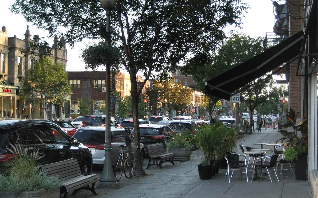
No matter how you personally associate Sherbrooke Street, one must agree that it contains many convenient services that add to the city’s charm and uniqueness.
Officially, the street is part of Route 138, originally constructed in New France (1706) to link Montreal to Quebec City. Upon completion of the Chemin du Roy, it was the longest road in North America, stretching 250 kilometres and taking approximately five days to travel. Today, it covers 1,420 kilometres – from the intersection of New York State Route 30 at Constable, New York, to Route 510 at Blanc Sablon. To this day, the route is still under construction, with new segments along the Lower North Shore connecting La Romaine to Tête-à-Baleine and Tabatière to Vieux-Fort. Within this historical context, the portion that traverses our fair city is named Sherbrooke Street West.
In 1996, a proposal to rename the street after Robert Bourassa sparked fierce opposition from many sectors across the Island of Montreal. Fortunately, this led (former) Mayor Pierre Bourque to withdraw his council’s proposition. There was also a (long-forgotten) prior attempt in 1990 to rename Sherbrooke Street in honour of Charles de Gaulle. Proposed by the St. Jean Baptiste Society, their suggestion received minimal support. Jack Todd, writing in the Montreal Gazette, stated: “…Not that I am completely opposed to naming something after de Gaulle. It would be appropriate, I think, to put up a pile of rocks in some secluded spot on Mount Royal. And we’ll call them de Gaulle stones, so that everyone can remember what an enormous pain this man really was.”
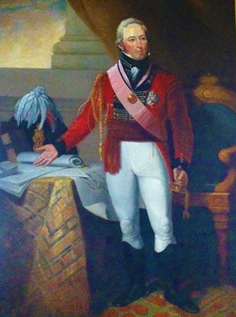
Sir John Sherbrooke by Robert Field, The Halifax Club, Halifax, Nova Scotia • Image: Public Domain
Have you wondered who (or what) the street honours? The street was originally named Sainte-Marie Street, and in about 1817 it was renamed Sherbrooke Street to commemorate Sir John Coape Sherbrooke, GCB (1764 – 1830), governor-in-chief of British North America from 1816-1818.
In himself, the life of John Sherbrooke deserves a separate article. In short, he was born in Arnold, Nottinghamshire and began an army career at the age of sixteen. He served under both Arthur Wellesley (later Duke of Wellington) and the Duke of York. He served in India during the Mysore War and Sicily and rose to the rank of lieutenant general. In 1811, he was appointed as lieutenant general of Nova Scotia.
During the War of 1812, Sherbrooke led an expeditionary force that occupied Castine (Maine) and its surrounding area, naming it the colony of New Ireland. His forces occupied the area for eight months, collecting customs revenues that contributed to Nova Scotia’s prosperity. To this end, a portion of these funds was used to finance the construction of Dalhousie College (today, Dalhousie University).
In 1816, in recognition of his service in the War of 1812, Sherbrooke was appointed as Governor General of British North America. Unfortunately, ill health forced him to resign two years later and return to his home in England.
Today, his name is commemorated not only on Sherbrooke Street, but in Sherbrooke, Nova Scotia, Sherbrooke, Quebec and Montreal’s Sherbrooke STM station. His legacy also includes one of the best-documented ghost stories of the period – as a junior officer, he saw a shadowy figure at the same time a fellow officer’s brother died. One has to agree that John Sherbrooke’s life is woven into the fabric of history, and not only should it be commemorated but remembered.
‘In 1816, in recognition of his service in the War of 1812, Sherbrooke was appointed as Governor General of British North America.’
Now that we have become well acquainted with John Sherbrooke, let us turn our attention to the street that honours his name as it traverses Westmount’s city limits.
The first mention of the street is in the Council minutes (1875) when a proposal was made to open and extend its length contingent upon assent by the proprietors:
“…That Sherbrooke Street be opened and continued from the first angle west of Clark Avenue and nearly opposite Martin’s store in said Municipality in a direct line parallel to Western Avenue to a point intersecting Molson Avenue and to be of uniform width of Eighty (80) feet French measure… before such extension shall be carried out, three fourths of the interested parties shall assent thereto…”
– Council Minutes, April 1875
Once opened, the street’s width was reduced to sixty feet (French measure) and extended, in 1880, from Clarke to Victoria Avenues – traversing the estates of W. E. Philips and E. Hudson. During that period, the street contained several bridges adjoining properties and belonging to the Montreal Toboggan Club, as well as a toll bar. The latter was controlled by the Montreal Turnpike Trust in a manner similar to that of Western Avenue. In a move to have them removed, the Municipality offered the Turnpike Trust $400 per year for five years, provided the road was kept in good repair.
The Trustees responded by stating that they would remove the toll bar on the western portion of the municipality and open the road if the Municipality pays $800 per year for 10 years. After which, the land may be homologated. Council refused this offer; however, by 1886, both parties agreed to $600 per year for 10 years. At one point, Sherbrooke Street was renamed Sherbrooke Avenue. This was the result of Council passing a resolution that all roads running westward be called avenues. For some reason, this change did not pass the test of time.
By 1888, street lighting had been installed, and discussions had begun with the City of Notre-Dame-de-Grâce regarding the extension of Sherbrooke Street into their municipality. Before this could occur, however, the street needed to be extended westwards from Clarke Avenue. By 1891, the municipality expropriated portions of Sherbrooke Street and opened it to the city’s western limits. At the same time, sewers were laid – paid, in part by the fronting proprietors unless they ceded their land. This extension traversed the Grey Nun’s property, between Clarke and Kensington Avenues, as well as the Monk and Raynes estates.
‘By 1895, water mains had been laid westward from Victoria Avenue to the city limits, many of which are still in use today.’
By 1893, the portion from Greene Avenue to Clarke Avenue (commonly referred to as “continuation of Sherbrooke Street” or “Cote Saint Antoine Road”) was officially renamed Sherbrooke Street and widened to seventy-five feet (English measure) using land expropriated from the fronting proprietors. One can gain a sense of the size of the lots during that period – only nine proprietors owned property within that section of Sherbrooke Street. This works project stalled when the Grey Nuns refused Council’s offer of 5 cents per foot, for 4,147 feet, forcing a by-law to widen the street. The by-law was contested in the Superior Court, which ruled against the Town. By 1896, the street had been widened and paid for through special assessments.
The same year, other improvements included the Montreal Street Railway laying a single rail from Greene to Victoria Avenues and installing drains from Clarke to Kensington Avenues. A sidewalk was laid on the south side of the street, and the road surface was macadamized the following year. By 1895, water mains had been laid westward from Victoria Avenue to the city limits, many of which are still in use today.
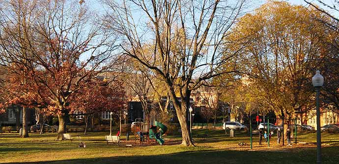
The future of the Sherbrooke Park Property, today’s Westmount Park, was assigned to J. Howard Manning, of Reading, Massachusetts. In 1896, Council asked his company to design a working plan for a proposed park. That same year, the Park and Island Railway constructed a waiting room at the corner of Victoria Avenue and Sherbrooke Street.
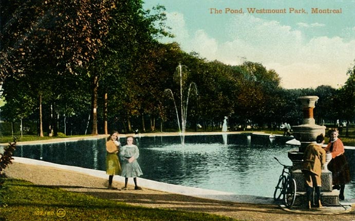
Sailing pond at Melville and Sherbrooke
One year later, Council used the land comprising a gore bounded by Sherbrooke Street, Argyle Avenue, and Côte St. Antoine Road for a public park. By 1900, the street was widened from Victoria Avenue westward by expropriating five-foot strips on either side and partially paid for by the fronting proprietors.
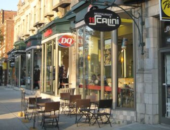
Commercialization of Sherbrooke Street began between 1910 and 1911 and proved divisive. One group supported commercial establishments along its entire length – others favoured a more restrictive approach. Favouring the latter approach, Council passed a by-law allowing retail establishments between Victoria and Grosvenor Avenues.
Another addition to the street occurred in 1911, when the Government of Canada purchased land to construct the Westmount Post Office. Further improvements that year included the construction of an underground comfort station at the northwesterly corner of Sherbrooke Street and Victoria Avenue (today beneath a hardware store). By 1919, a bubble fountain had been added at that same corner. More green space was added in 1913, when the Town purchased a lot comprising 19,740 square feet on the southeasterly corner of Sherbrooke Street and Lansdowne Avenue. Today, the defining feature of this area is the city’s floral clock.
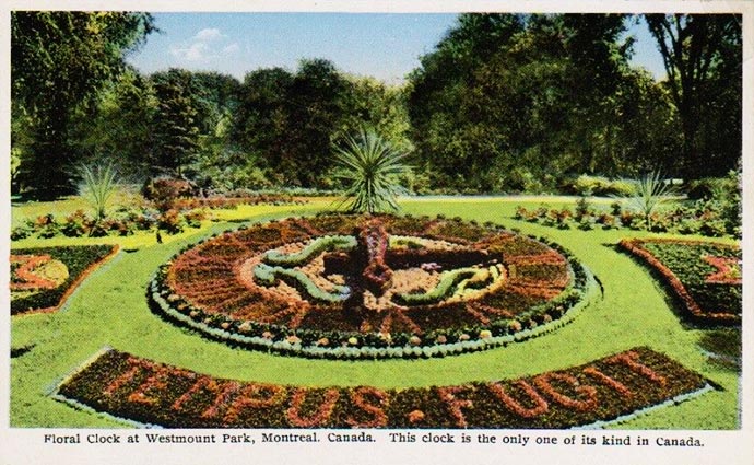
Westmount Floral Clock 1927 postcard
A major step in beautifying the street was the construction of underground conduits in 1914 to carry electrical cables. That same year, the Town ordered the Montreal Electric Light Company to remove all their poles from the street. This was followed by new light fixtures that provided a brilliance rarely seen in towns at the time.
“Inauguration of the new ornamental lights on Sherbrooke Street… fifty-six new cluster lights were now being put into service… thus making a uniform white way on Sherbrooke Street throughout its whole length… these standard lights were considered to be the best on the continent.”
– Montreal Gazette, November 1914
‘Commercialization of Sherbrooke Street began between 1910 and 1911 and proved divisive. One group supported commercial establishments along its entire length – others favoured a more restrictive approach.’
At this point, the street became a desirable location to reside. To capitalize on this demand, developers purchased lots to construct apartment buildings at a rapid pace: Rosemont Avenue and Sherbrooke (1921), Strathcona and Sherbrooke (1924), Redfern and Sherbrooke (1925), between Arlington and Lansdowne (1926), Victoria Avenue and Sherbrooke (1927), between Greene and Olivier (1928). The gasoline station at the corner of Grosvenor Avenue and Sherbrooke Street (still standing) dates back to 1917 – at that time, the structure was described as a beautiful house.
Along with residential and commercial growth, places of worship became a feature along the street: Westmount Baptist Church (1923), Temple Emanu-el (1914) and the Church of the Ascension (1927). The side of Sherbrooke Street, between Victoria and Grosvenor Avenues, was owned by Steinberg’s Wholesale Groceteria. In 1938, the company erected stores with apartments on the upper levels. That same year, the municipality opened a lane from Victoria to Grosvenor Avenues. (A favourite shortcut for drivers avoiding traffic lights.)
Queen Elizabeth Gardens • Image: © Andrew Burlone
More green space was added in 1940, with the city purchasing property forming today’s Queen Elizabeth Gardens, and in 1957, the municipality proposed constructing an artificial ice rink at the corner of Sherbrooke Street and Melville Avenue. Strong opposition forced Council to relocate its construction to its present site adjacent to Lansdowne Avenue.
The ensuing years saw a peaceful coexistence between neighbouring Notre-Dame-de-Grâce and the City of Montreal – each maintaining a balance between transportation needs and residential and commercial growth, collectively contributing to the street’s uniqueness. One example is the annual merchant street festival, started in 1977, showcasing a variety of products available within walking distance for most residents.
Read also Westmount Places: Sherbrooke Street /part 2
Feature image: © Andrew Burlone

More articles by Michael Walsh
Other recent articles


 May 19, 2026" />
 Sherbrooke Street /2" />
 and manage anxiety" />
 Vegan Shepherd’s Pie" />
 through gesture and gaze" />
 spring and summer" />
 is back for a new run!" />
 Sherbrooke Street /1" />
 the Colorado Rockies" />
 of decision-making" />
 Thai Lemongrass Soup" />
 its 2026-2027 season" />
 Investing with life insurance" />
 Stories and emotions" />
 Gentle speech as resistance" />

 strengthen their partnership" />
 Peanut Butter Dog Treats" />
 the ideal job candidate" />
 Costa Rica’s simpler living" />
 sings Orlando di Lasso" />
 for all seasons" />
I would like to add that the Church of the Ascension of Our Lord, on Sherbrooke West at the corner of Clarke Avenue, is celebrating its centennial on Sunday, May 24th, 2026.
the street would be a fascinating book project